
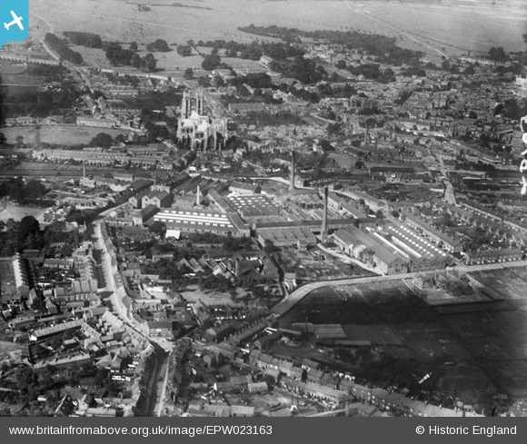
EPW023163 ENGLAND (1928). The Minster and Hodgson's Tannery, Beverley, 1928
© Copyright OpenStreetMap contributors and licensed by the OpenStreetMap Foundation. 2024. Cartography is licensed as CC BY-SA.
Nearby Images (31)
EPW023163

EPW023162

EAW035020

EPW023164

EPW023165

EAW035028

EAW035030

EAW035027

EAW004520

EAW035025

EPW023169

EAW035022

EAW035029

EPW023167

EAW004517

EAW004519

EAW004516

EAW035024

EAW035021

EAW035023

EAW004521

EAW004526

EAW035026

EAW004524

EAW004518

EAW004522

EAW004523

EAW018617

EAW004525

EAW018625

EAW018620

Details
| Title | [EPW023163] The Minster and Hodgson's Tannery, Beverley, 1928 |
| Reference | EPW023163 |
| Date | August-1928 |
| Link | |
| Place name | BEVERLEY |
| Parish | BEVERLEY |
| District | |
| Country | ENGLAND |
| Easting / Northing | 504033, 439320 |
| Longitude / Latitude | -0.41877280173573, 53.83948803033 |
| National Grid Reference | TA040393 |
Pins
 Mark |
Wednesday 4th of March 2020 01:09:01 PM | |
Mark |
Wednesday 4th of March 2020 01:06:14 PM |


