
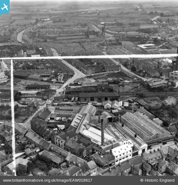
EAW018617 ENGLAND (1948). The Armstrong's Patents Co Ltd Engineering Works and Goods Shed, Beverley, 1948. This image has been produced from a print marked by Aerofilms Ltd for photo editing.
© Copyright OpenStreetMap contributors and licensed by the OpenStreetMap Foundation. 2024. Cartography is licensed as CC BY-SA.
Nearby Images (38)
EAW018617

EAW018625

EAW004523

EAW018620

EAW004518

EAW018616

EAW018622

EAW018618

EAW004520

EAW004524

EAW018644

EPW023167

EAW018619

EAW018621

EPW023165

EPW023164

EAW018624

EPW023162

EAW018623

EPW023169

EPW023163

EAW035030

EAW035028

EAW004519

EAW035017

EAW004517

EAW035020

EAW035027

EPW023166

EPW023168

EAW035029

EPW012710

EPW023161

EPW012711

EAW035019

EAW035018

EAW035025

EAW035022

Details
| Title | [EAW018617] The Armstrong's Patents Co Ltd Engineering Works and Goods Shed, Beverley, 1948. This image has been produced from a print marked by Aerofilms Ltd for photo editing. |
| Reference | EAW018617 |
| Date | 10-September-1948 |
| Link | |
| Place name | BEVERLEY |
| Parish | BEVERLEY |
| District | |
| Country | ENGLAND |
| Easting / Northing | 503893, 439485 |
| Longitude / Latitude | -0.42084401330932, 53.840998660982 |
| National Grid Reference | TA039395 |
Pins
Be the first to add a comment to this image!


