
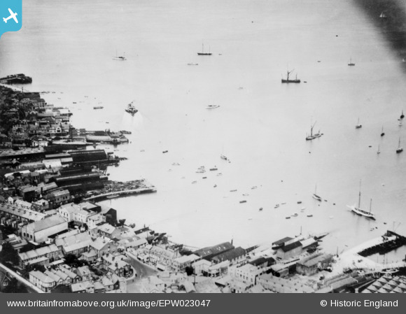
EPW023047 ENGLAND (1928). Cowes Harbour, Cowes, 1928. This image has been produced from a copy-negative.
© Copyright OpenStreetMap contributors and licensed by the OpenStreetMap Foundation. 2024. Cartography is licensed as CC BY-SA.
Nearby Images (12)
EPW023047

EAW025042

EAW025043

EPW023046

EAW025041

EPW022954

EAW025039

EAW025037

EPW039664

EPW023051

EAW025044

EAW025045

Details
| Title | [EPW023047] Cowes Harbour, Cowes, 1928. This image has been produced from a copy-negative. |
| Reference | EPW023047 |
| Date | August-1928 |
| Link | |
| Place name | COWES |
| Parish | COWES |
| District | |
| Country | ENGLAND |
| Easting / Northing | 449848, 96095 |
| Longitude / Latitude | -1.293149287363, 50.7617344237 |
| National Grid Reference | SZ498961 |
Pins
Be the first to add a comment to this image!


