
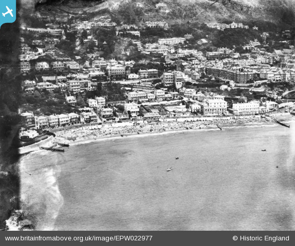
EPW022977 ENGLAND (1928). The sea front, Ventnor, 1928. This image has been produced from a damaged print.
© Copyright OpenStreetMap contributors and licensed by the OpenStreetMap Foundation. 2024. Cartography is licensed as CC BY-SA.
Nearby Images (26)
EPW022977

EPW039653

EPW022979

EPW043013

EPW023098

EAW015242

EPW032288

EPW039654

EAW038592

EPW043010

EPW032286

EAW022209

EPW043014

EAW038594

EPW039656

EAW015243

EPW022982

EPW023099

EAW022207

EPW032285

EPW022987

EPW023097

EPW023096

EAW022210

EAW022208

EPW000777

Details
| Title | [EPW022977] The sea front, Ventnor, 1928. This image has been produced from a damaged print. |
| Reference | EPW022977 |
| Date | August-1928 |
| Link | |
| Place name | VENTNOR |
| Parish | VENTNOR |
| District | |
| Country | ENGLAND |
| Easting / Northing | 456130, 77374 |
| Longitude / Latitude | -1.206920852631, 50.592804310713 |
| National Grid Reference | SZ561774 |
Pins
Be the first to add a comment to this image!


