
EPW020441 ENGLAND (1928). Central Bridge Tramway, Southampton, 1928

© Copyright OpenStreetMap contributors and licensed by the OpenStreetMap Foundation. 2024. Cartography is licensed as CC BY-SA.
Nearby Images (10)
EPW020441

EAW283939

EAW008788

EAW008790

EAW008789

EAW008787

EAW008786

EAW008813

EPW001505

EPW020449

Details
| Title | [EPW020441] Central Bridge Tramway, Southampton, 1928 |
| Reference | EPW020441 |
| Date | 16-March-1928 |
| Link | |
| Place name | SOUTHAMPTON |
| Parish | |
| District | |
| Country | ENGLAND |
| Easting / Northing | 442892, 111230 |
| Longitude / Latitude | -1.3900084032941, 50.898399986694 |
| National Grid Reference | SU429112 |
Pins

User Comment Contributions
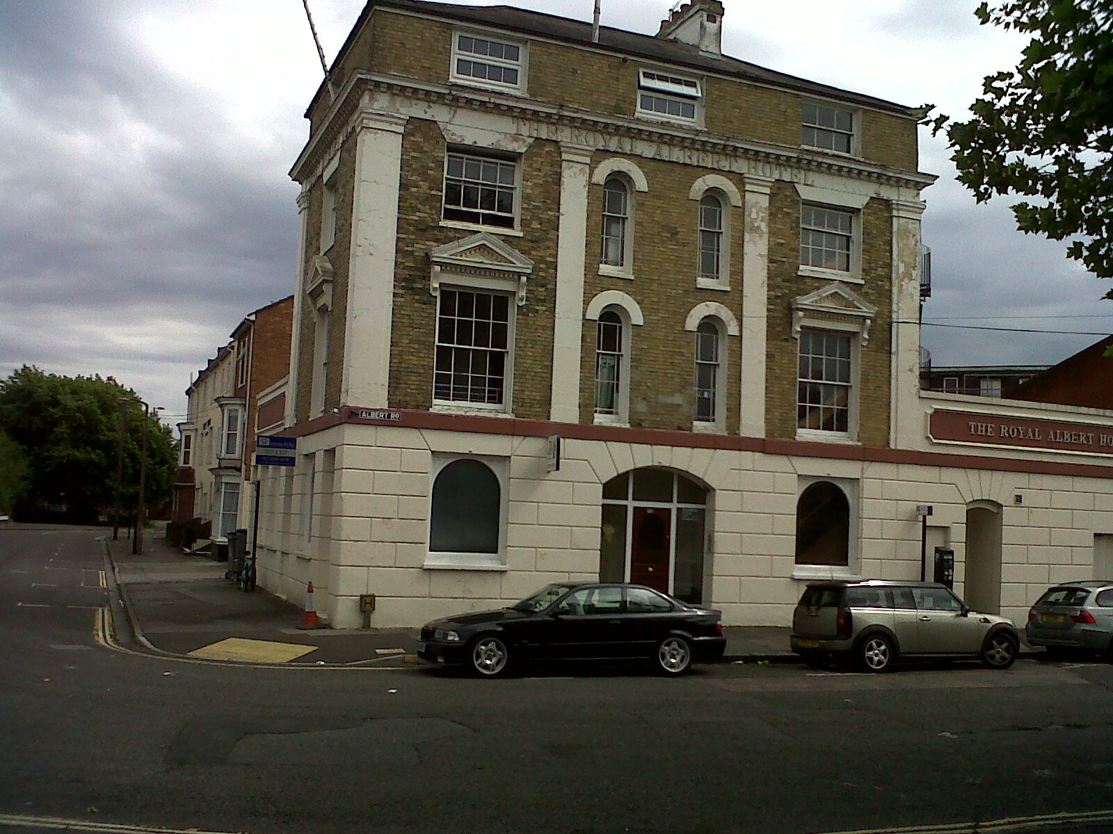 The Royal Albert Hotel today. |
 Class31 |
Monday 5th of August 2013 10:29:57 PM |
View looking east. From what I can see practically the only buildings which are unchanged are the row leading east of the Royal Albert Hotel. The remainder appear to have vanished under bombing, roads or slum clearance. |
Class31 |
Friday 3rd of August 2012 10:07:17 PM |


