
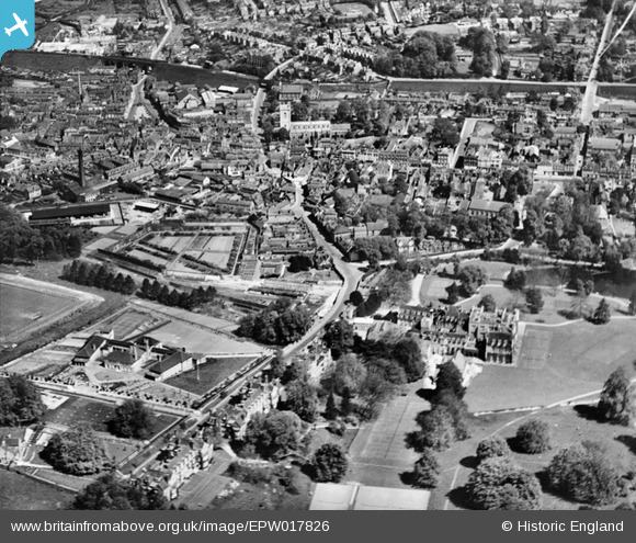
EPW017826 ENGLAND (1927). The town centre including Wycombe Abbey, High Wycombe, from the south, 1927
© Copyright OpenStreetMap contributors and licensed by the OpenStreetMap Foundation. 2024. Cartography is licensed as CC BY-SA.
Nearby Images (11)
EPW017826

EPW034491

EPW034496

EPW034492

EAW024278

EPW052764

EPW038416

EPW038415

EPW017821

EAW024279

EPW052765

Details
| Title | [EPW017826] The town centre including Wycombe Abbey, High Wycombe, from the south, 1927 |
| Reference | EPW017826 |
| Date | April-1927 |
| Link | |
| Place name | HIGH WYCOMBE |
| Parish | |
| District | |
| Country | ENGLAND |
| Easting / Northing | 486466, 192594 |
| Longitude / Latitude | -0.75075715583244, 51.625043515224 |
| National Grid Reference | SU865926 |
Pins
 gBr |
Tuesday 6th of January 2015 10:08:21 PM |


