
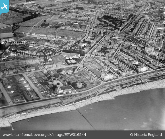
EPW016544 ENGLAND (1926). Ellis Road, Martello Tower F and environs, Clacton-on-Sea, 1926
© Copyright OpenStreetMap contributors and licensed by the OpenStreetMap Foundation. 2024. Cartography is licensed as CC BY-SA.
Nearby Images (9)
EPW016544

EPW016544
EPW001870

EPW011621

EPW049295

EPW039155

EPW049143

EPW001994

EPW046895

Details
| Title | [EPW016544] Ellis Road, Martello Tower F and environs, Clacton-on-Sea, 1926 |
| Reference | EPW016544 |
| Date | August-1926 |
| Link | |
| Place name | CLACTON-ON-SEA |
| Parish | |
| District | |
| Country | ENGLAND |
| Easting / Northing | 617255, 214474 |
| Longitude / Latitude | 1.1503437791504, 51.786220411264 |
| National Grid Reference | TM173145 |
Pins
 Amiguru |
Sunday 12th of October 2014 05:50:53 PM | |
Amiguru |
Sunday 12th of October 2014 05:40:38 PM | |
Amiguru |
Friday 10th of October 2014 08:22:36 PM | |
Amiguru |
Friday 10th of October 2014 08:21:53 PM | |
Amiguru |
Friday 10th of October 2014 08:20:12 PM | |
Amiguru |
Friday 10th of October 2014 08:16:27 PM | |
Amiguru |
Friday 10th of October 2014 08:14:09 PM | |
Amiguru |
Friday 10th of October 2014 08:11:43 PM | |
Amiguru |
Friday 10th of October 2014 08:10:57 PM | |
Davel |
Monday 2nd of June 2014 02:57:31 PM | |
Known as Martello Tower 'F' |
Amiguru |
Friday 10th of October 2014 08:13:09 PM |


