
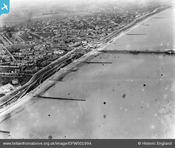
EPW001994 ENGLAND (1920). General view of the town and pier, Clacton-on-Sea, 1920
© Copyright OpenStreetMap contributors and licensed by the OpenStreetMap Foundation. 2024. Cartography is licensed as CC BY-SA.
Nearby Images (25)
EPW001994

EAW048925

EPW046896

EPW011620

EPW058724

EPW039155

EAW038332

EAW048924

EPW058728

EPW041338

EPW039151

EPW001992

EPW039154

EPW039124

EPW001870

EPW039152

EPW039150

EPW039148

EPW039143

EPW041340

EPW011619

EPW011623

EPW016544

EPW016544
EAW038331

Details
| Title | [EPW001994] General view of the town and pier, Clacton-on-Sea, 1920 |
| Reference | EPW001994 |
| Date | June-1920 |
| Link | |
| Place name | CLACTON-ON-SEA |
| Parish | |
| District | |
| Country | ENGLAND |
| Easting / Northing | 617504, 214305 |
| Longitude / Latitude | 1.1538426294937, 51.78460632024 |
| National Grid Reference | TM175143 |
Pins
Be the first to add a comment to this image!


