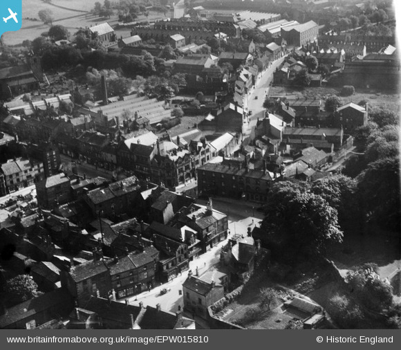
EPW015810 ENGLAND (1926). Westgate and the Victoria Printing Works, Otley, 1926
© Copyright OpenStreetMap contributors and licensed by the OpenStreetMap Foundation. 2024. Cartography is licensed as CC BY-SA.
Nearby Images (12)
Details
| Title | [EPW015810] Westgate and the Victoria Printing Works, Otley, 1926 |
| Reference | EPW015810 |
| Date | 5-June-1926 |
| Link | |
| Place name | OTLEY |
| Parish | OTLEY |
| District | |
| Country | ENGLAND |
| Easting / Northing | 420152, 445550 |
| Longitude / Latitude | -1.6932325427048, 53.905516306472 |
| National Grid Reference | SE202456 |
Pins
Be the first to add a comment to this image!


![[EPW015810] Westgate and the Victoria Printing Works, Otley, 1926](http://britainfromabove.org.uk/sites/all/libraries/aerofilms-images/public/100x100/EPW/015/EPW015810.jpg)
![[EPW015812] Manor Square, Otley, 1926](http://britainfromabove.org.uk/sites/all/libraries/aerofilms-images/public/100x100/EPW/015/EPW015812.jpg)
![[EPW015803] The market place and environs, Otley, 1926](http://britainfromabove.org.uk/sites/all/libraries/aerofilms-images/public/100x100/EPW/015/EPW015803.jpg)
![[EPW015802] Manor Square and the town centre, Otley, 1926](http://britainfromabove.org.uk/sites/all/libraries/aerofilms-images/public/100x100/EPW/015/EPW015802.jpg)
![[EPW015840] Manor Square, Otley, 1926](http://britainfromabove.org.uk/sites/all/libraries/aerofilms-images/public/100x100/EPW/015/EPW015840.jpg)
![[EPW024483] The Market Place and environs, Otley, 1928](http://britainfromabove.org.uk/sites/all/libraries/aerofilms-images/public/100x100/EPW/024/EPW024483.jpg)
![[EPW024701] The Market Place, Otley, 1928](http://britainfromabove.org.uk/sites/all/libraries/aerofilms-images/public/100x100/EPW/024/EPW024701.jpg)
![[EPW015805] The market place, Otley, 1926](http://britainfromabove.org.uk/sites/all/libraries/aerofilms-images/public/100x100/EPW/015/EPW015805.jpg)
![[EPW024484] All Saints' Church, Otley, 1928. This image has been produced from a damaged negative.](http://britainfromabove.org.uk/sites/all/libraries/aerofilms-images/public/100x100/EPW/024/EPW024484.jpg)
![[EPW015911] The Ashfield Iron Foundry, Otley, 1926](http://britainfromabove.org.uk/sites/all/libraries/aerofilms-images/public/100x100/EPW/015/EPW015911.jpg)
![[EPW015914] The Atlas Iron Works and Westgate, Otley, 1926](http://britainfromabove.org.uk/sites/all/libraries/aerofilms-images/public/100x100/EPW/015/EPW015914.jpg)
![[EPW015913] The Atlas Iron Works and town centre, Otley, 1926](http://britainfromabove.org.uk/sites/all/libraries/aerofilms-images/public/100x100/EPW/015/EPW015913.jpg)


