
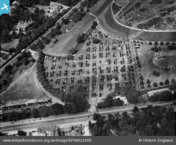
EPW013406 ENGLAND (1925). Ascot, Royal Ascot, 1925
© Copyright OpenStreetMap contributors and licensed by the OpenStreetMap Foundation. 2024. Cartography is licensed as CC BY-SA.
Nearby Images (19)
EPW013406

EPW008714

EPW013402

EPW026288

EPW008710
, Ascot, 1923")
EAW022116

EPW036159

EAW036303

EAW036305

EPW008716

EAW036308

EAW036302

EAW036306

EAW036301

EPW026283

EPW036162

EPW036161

EAW022114

EPW006700

Details
| Title | [EPW013406] Ascot, Royal Ascot, 1925 |
| Reference | EPW013406 |
| Date | 17-June-1925 |
| Link | |
| Place name | ASCOT |
| Parish | SUNNINGHILL AND ASCOT |
| District | |
| Country | ENGLAND |
| Easting / Northing | 491548, 168928 |
| Longitude / Latitude | -0.68350320246146, 51.411479972641 |
| National Grid Reference | SU915689 |
Pins
Be the first to add a comment to this image!


