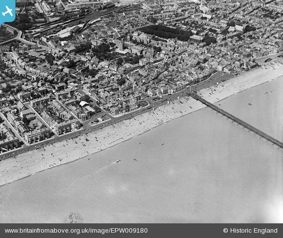
EPW009180 ENGLAND (1923). The pier and Prince of Wales Road area, Deal, 1923
© Copyright OpenStreetMap contributors and licensed by the OpenStreetMap Foundation. 2024. Cartography is licensed as CC BY-SA.
Nearby Images (14)
EPW009180

EPW009179

EPW035436

EPW042831

EPW039320

EPW009177

EPW019061

EPW039322

EPW000388

EPW042832

EPW035437

EPW009178

EPW009181

EPW000646

Details
| Title | [EPW009180] The pier and Prince of Wales Road area, Deal, 1923 |
| Reference | EPW009180 |
| Date | 1923 |
| Link | |
| Place name | DEAL |
| Parish | DEAL |
| District | |
| Country | ENGLAND |
| Easting / Northing | 637828, 152568 |
| Longitude / Latitude | 1.4063787005691, 51.222162244797 |
| National Grid Reference | TR378526 |
Pins
 Alan McFaden |
Wednesday 9th of July 2014 10:23:48 AM | |
Alan McFaden |
Wednesday 9th of July 2014 10:23:23 AM | |
Alan McFaden |
Wednesday 9th of July 2014 10:22:49 AM | |
Alan McFaden |
Wednesday 9th of July 2014 10:22:23 AM |