
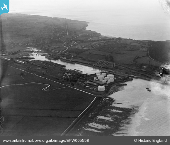
EPW005558 ENGLAND (1921). Portishead Dock, Portishead, from the east, 1921
© Copyright OpenStreetMap contributors and licensed by the OpenStreetMap Foundation. 2024. Cartography is licensed as CC BY-SA.
Nearby Images (3)
EPW005558

EPW008654

EPW005559

Details
| Title | [EPW005558] Portishead Dock, Portishead, from the east, 1921 |
| Reference | EPW005558 |
| Date | 20-March-1921 |
| Link | |
| Place name | PORTBURY WHARF |
| Parish | PORTBURY |
| District | |
| Country | ENGLAND |
| Easting / Northing | 347840, 177166 |
| Longitude / Latitude | -2.7513685988795, 51.490547575036 |
| National Grid Reference | ST478772 |


