
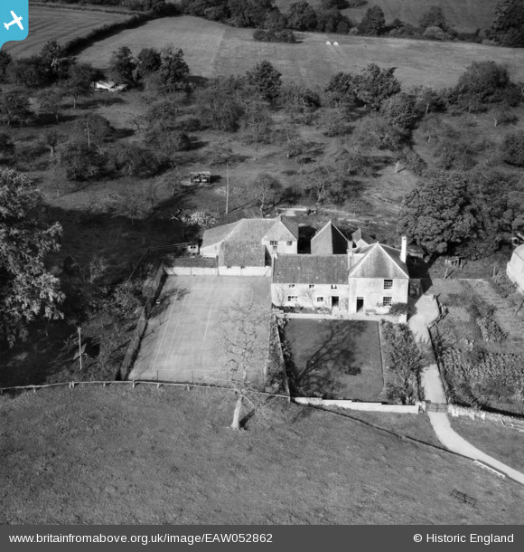
EAW052862 ENGLAND (1953). Ditcheat Hill Farm, Ditcheat, 1953
© Copyright OpenStreetMap contributors and licensed by the OpenStreetMap Foundation. 2024. Cartography is licensed as CC BY-SA.
Nearby Images (7)
EAW052862

EAW052859

EAW052865

EAW052858

EAW052861

EAW052860

EAW052863

Details
| Title | [EAW052862] Ditcheat Hill Farm, Ditcheat, 1953 |
| Reference | EAW052862 |
| Date | 16-October-1953 |
| Link | |
| Place name | DITCHEAT |
| Parish | DITCHEAT |
| District | |
| Country | ENGLAND |
| Easting / Northing | 362168, 137045 |
| Longitude / Latitude | -2.5407272387758, 51.130904330383 |
| National Grid Reference | ST622370 |
Pins
Be the first to add a comment to this image!
User Comment Contributions
 Ditcheat Hill Farm, Ditcheat, 16/11/2015 |
 Class31 |
Monday 16th of November 2015 04:05:58 PM |


