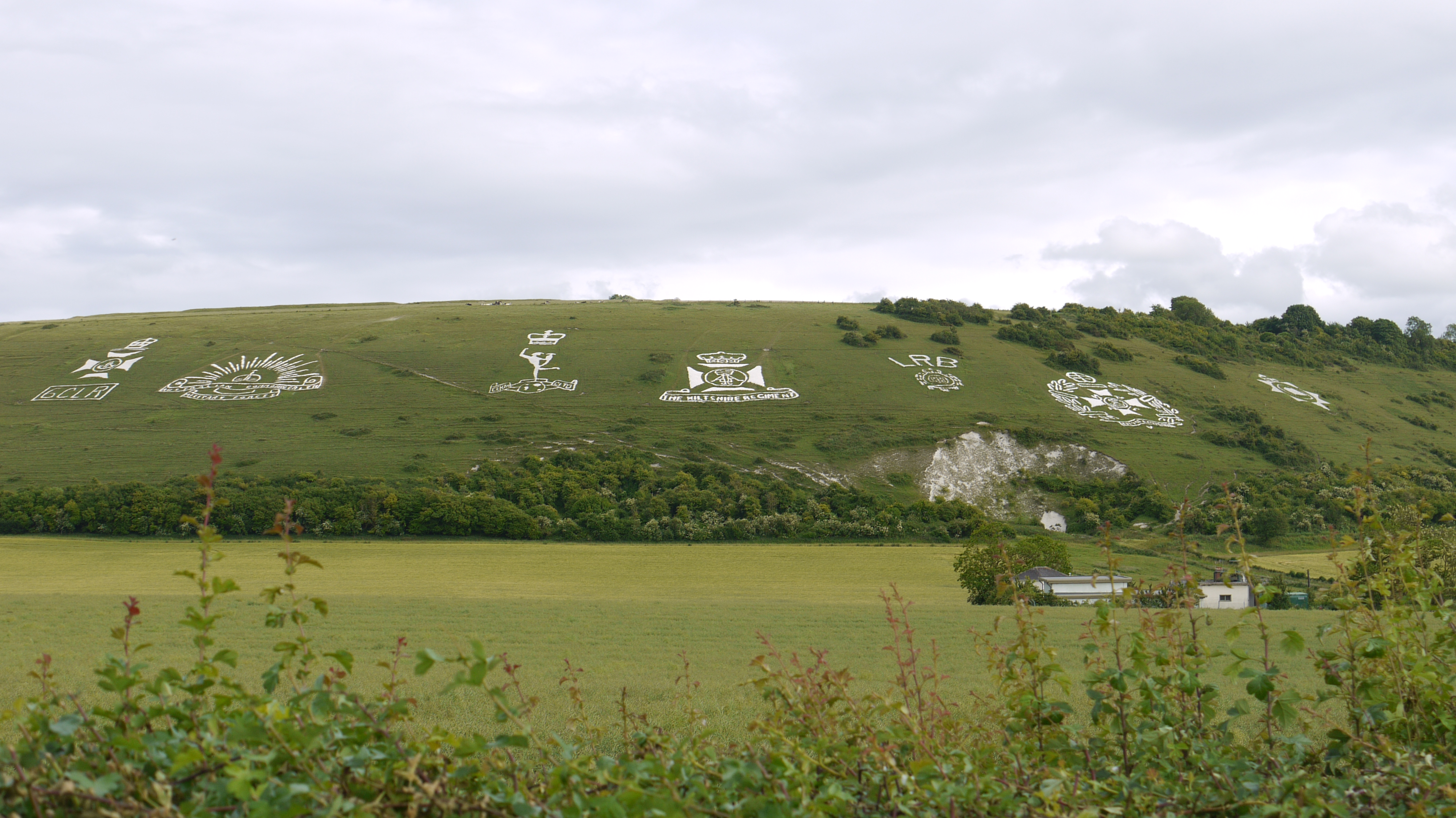
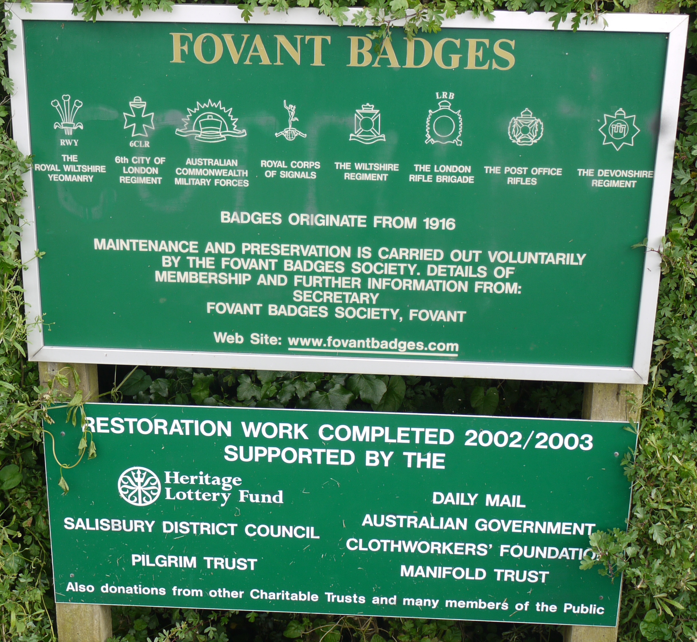
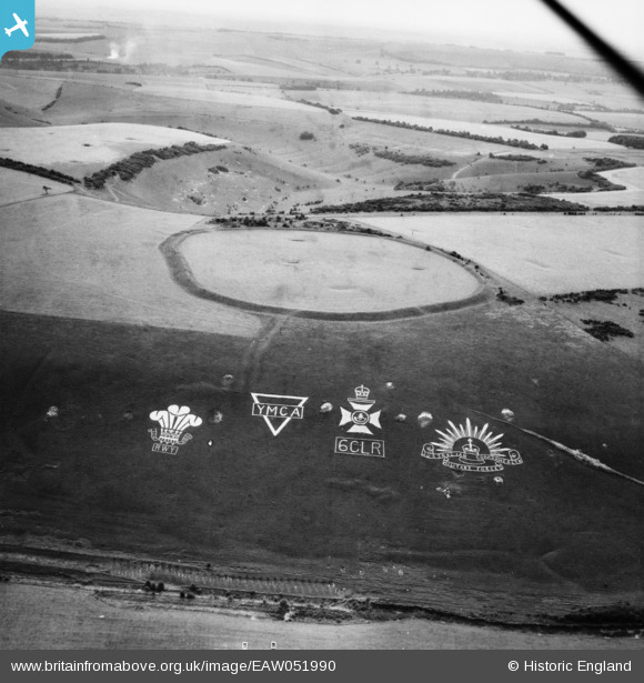
EAW051990 ENGLAND (1953). The Fovant Badges and Chiselbury Camp, Fovant, from the north-west, 1953
© Copyright OpenStreetMap contributors and licensed by the OpenStreetMap Foundation. 2024. Cartography is licensed as CC BY-SA.
Nearby Images (9)
EAW051990

EAW031930

EAW031929

EAW031927

EAW051989

EAW038618

EAW038619

EAW005105

EAW051994

Details
| Title | [EAW051990] The Fovant Badges and Chiselbury Camp, Fovant, from the north-west, 1953 |
| Reference | EAW051990 |
| Date | 5-September-1953 |
| Link | |
| Place name | FOVANT |
| Parish | FOVANT |
| District | |
| Country | ENGLAND |
| Easting / Northing | 401715, 128389 |
| Longitude / Latitude | -1.9755282932159, 51.054307189128 |
| National Grid Reference | SU017284 |
Pins
Be the first to add a comment to this image!