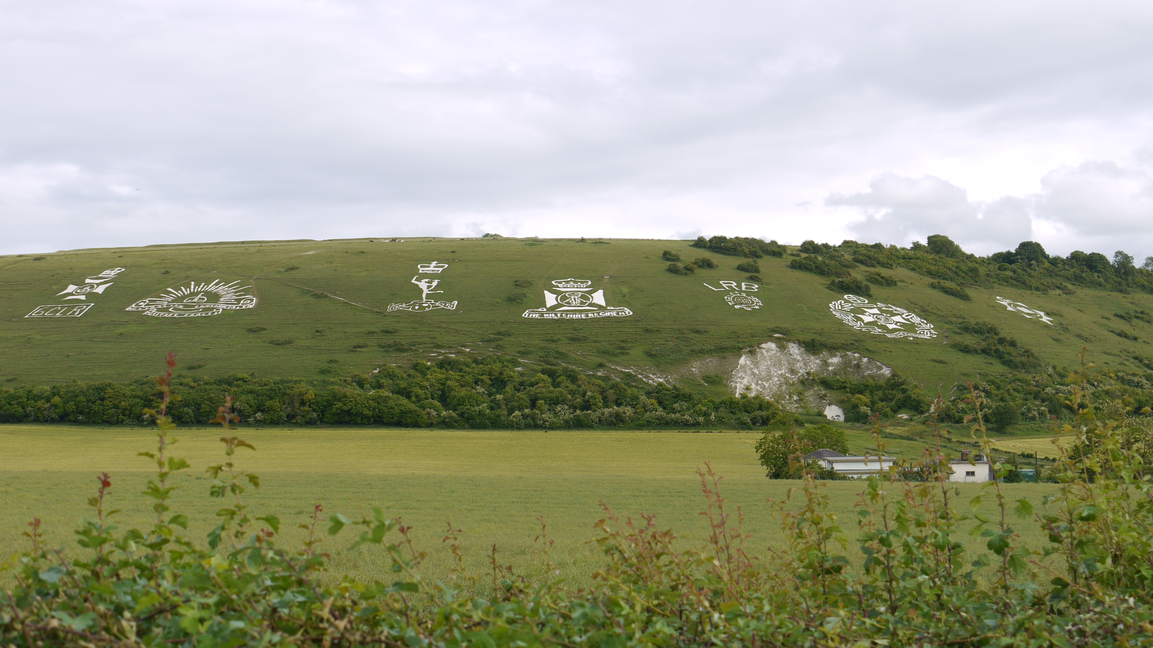
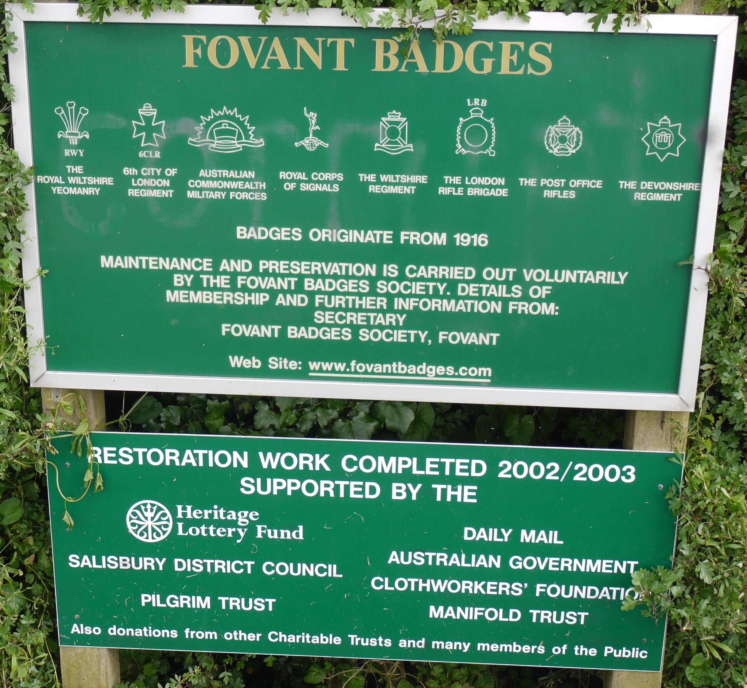
EAW051989 ENGLAND (1953). The Fovant Badges and Chiselbury Camp, Fovant, 1953

© Copyright OpenStreetMap contributors and licensed by the OpenStreetMap Foundation. 2024. Cartography is licensed as CC BY-SA.
Nearby Images (11)
EAW051989

EAW005105

EAW005104

EAW031929

EAW051990

EAW031930

EAW031927

EAW038619

EAW051994

EAW038618

EAW051991

Details
| Title | [EAW051989] The Fovant Badges and Chiselbury Camp, Fovant, 1953 |
| Reference | EAW051989 |
| Date | 5-September-1953 |
| Link | |
| Place name | FOVANT |
| Parish | FOVANT |
| District | |
| Country | ENGLAND |
| Easting / Northing | 401715, 128233 |
| Longitude / Latitude | -1.9755290326245, 51.052904250971 |
| National Grid Reference | SU017282 |
Pins
 wayfarer |
Friday 20th of February 2015 04:43:03 PM |