
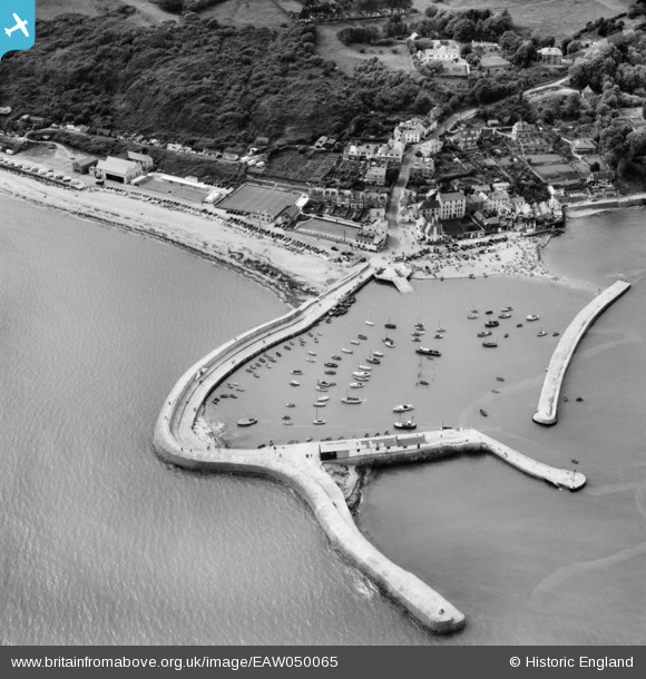
EAW050065 ENGLAND (1953). The Cobb, Lyme Regis, 1953
© Copyright OpenStreetMap contributors and licensed by the OpenStreetMap Foundation. 2024. Cartography is licensed as CC BY-SA.
Nearby Images (8)
EAW050065

EPW013476

EPW024178

EPW023895

EPW023894

EPW039714

EAW033661

EPW039716

Details
| Title | [EAW050065] The Cobb, Lyme Regis, 1953 |
| Reference | EAW050065 |
| Date | 25-June-1953 |
| Link | |
| Place name | LYME REGIS |
| Parish | LYME REGIS |
| District | |
| Country | ENGLAND |
| Easting / Northing | 333840, 91590 |
| Longitude / Latitude | -2.9373187492568, 50.719592292057 |
| National Grid Reference | SY338916 |
Pins
 Dylan Moore |
Wednesday 11th of November 2015 02:02:34 PM | |
 ken |
Sunday 9th of August 2015 02:23:16 PM | |
Al |
Sunday 8th of June 2014 10:30:20 AM | |
 Alan McFaden |
Saturday 7th of June 2014 07:35:35 PM | |
Alan McFaden |
Saturday 7th of June 2014 07:34:54 PM | |
Alan McFaden |
Saturday 7th of June 2014 07:34:20 PM | |
Alan McFaden |
Saturday 7th of June 2014 07:33:43 PM |


