
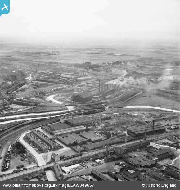
EAW049657 ENGLAND (1953). The industrial landscape of New York, Ickles and Templeborough, Rotherham, from the north-east, 1953
© Copyright OpenStreetMap contributors and licensed by the OpenStreetMap Foundation. 2024. Cartography is licensed as CC BY-SA.
Nearby Images (17)
EAW049657

EAW049661

EAW048633

EAW048632

EAW048649

EAW049658

EAW049660

EAW049662

EAW048631

EAW048634

EAW048629

EAW048636

EAW048635

EAW048637

EAW048630

EAW048638

EAW049659

Details
| Title | [EAW049657] The industrial landscape of New York, Ickles and Templeborough, Rotherham, from the north-east, 1953 |
| Reference | EAW049657 |
| Date | 24-May-1953 |
| Link | |
| Place name | ROTHERHAM |
| Parish | |
| District | |
| Country | ENGLAND |
| Easting / Northing | 442162, 392431 |
| Longitude / Latitude | -1.3654126890031, 53.42672463519 |
| National Grid Reference | SK422924 |
Pins
 Steeples |
Sunday 11th of April 2021 10:37:17 PM | |
redmist |
Tuesday 15th of January 2019 07:26:56 PM | |
redmist |
Tuesday 15th of January 2019 06:00:02 PM | |
John Wass |
Wednesday 17th of August 2016 09:54:02 PM | |
Rotherham Westgate station closed October 52. Start of tracks being recovered. |
Holmes Junction |
Wednesday 23rd of November 2016 03:07:11 PM |


