
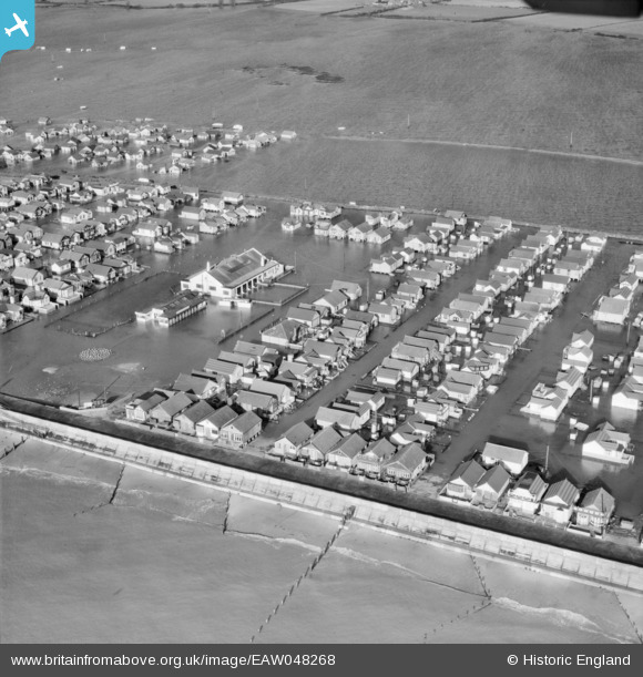
EAW048268 ENGLAND (1953). Flooding at the Brooklands Estate, Jaywick, 1953
© Copyright OpenStreetMap contributors and licensed by the OpenStreetMap Foundation. 2024. Cartography is licensed as CC BY-SA.
Nearby Images (5)
EAW048268

EAW048266

EAW048263

EAW048270

EAW048272

Details
| Title | [EAW048268] Flooding at the Brooklands Estate, Jaywick, 1953 |
| Reference | EAW048268 |
| Date | 2-February-1953 |
| Link | |
| Place name | JAYWICK |
| Parish | |
| District | |
| Country | ENGLAND |
| Easting / Northing | 614303, 212860 |
| Longitude / Latitude | 1.1066097877546, 51.77286698066 |
| National Grid Reference | TM143129 |
Pins
Be the first to add a comment to this image!


