
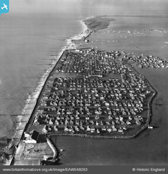
EAW048263 ENGLAND (1953). Damaged sea defences and flooding along the Essex coast, Jaywick, from the east, 1953. This image has been produced from a print.
© Copyright OpenStreetMap contributors and licensed by the OpenStreetMap Foundation. 2024. Cartography is licensed as CC BY-SA.
Nearby Images (6)
EAW048263

EAW048265

EAW048266

EAW048274

EAW048268

EAW048275

Details
| Title | [EAW048263] Damaged sea defences and flooding along the Essex coast, Jaywick, from the east, 1953. This image has been produced from a print. |
| Reference | EAW048263 |
| Date | 2-February-1953 |
| Link | |
| Place name | JAYWICK |
| Parish | |
| District | |
| Country | ENGLAND |
| Easting / Northing | 614542, 212888 |
| Longitude / Latitude | 1.1100862094171, 51.773026843251 |
| National Grid Reference | TM145129 |
Pins
Be the first to add a comment to this image!


