
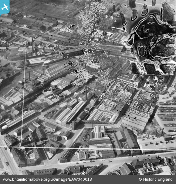
EAW040018 ENGLAND (1951). The Novo Steel Works and the surrounding industrial area, Attercliffe, 1951. This image has been produced from a damaged negative.
© Copyright OpenStreetMap contributors and licensed by the OpenStreetMap Foundation. 2024. Cartography is licensed as CC BY-SA.
Nearby Images (17)
EAW040018

EAW040024

EAW040019

EAW040020

EAW040025

EAW040023

EPW005955

EPW005953

EAW040021

EPW005956

EAW040022

EPW005950

EPW005954

EPW005951

EPW005952

EAW009656

EAW009657

Details
| Title | [EAW040018] The Novo Steel Works and the surrounding industrial area, Attercliffe, 1951. This image has been produced from a damaged negative. |
| Reference | EAW040018 |
| Date | 17-September-1951 |
| Link | |
| Place name | ATTERCLIFFE |
| Parish | |
| District | |
| Country | ENGLAND |
| Easting / Northing | 437236, 388582 |
| Longitude / Latitude | -1.440005206429, 53.392496199684 |
| National Grid Reference | SK372886 |


