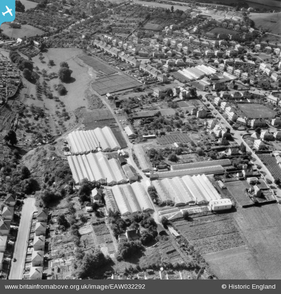
EAW032292 ENGLAND (1950). Nursery between Southdown Road and Coronation Avenue, Southdown, 1950
© Copyright OpenStreetMap contributors and licensed by the OpenStreetMap Foundation. 2024. Cartography is licensed as CC BY-SA.
Nearby Images (19)
EAW032292

EAW032287

EAW032291

EAW026390

EAW026392

EAW032289

EAW026389

EPW022216

EAW026394

EAW026393

EAW026391

EAW032286

EAW026396

EAW026395

EAW032288

EAW032290

EPW022215

EPW048401

EPW022213

Details
| Title | [EAW032292] Nursery between Southdown Road and Coronation Avenue, Southdown, 1950 |
| Reference | EAW032292 |
| Date | 5-September-1950 |
| Link | |
| Place name | SOUTHDOWN |
| Parish | |
| District | |
| Country | ENGLAND |
| Easting / Northing | 373026, 163611 |
| Longitude / Latitude | -2.3875429485811, 51.370418536618 |
| National Grid Reference | ST730636 |