
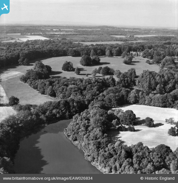
EAW026834 ENGLAND (1949). Furnace Pond looking towards Ashfold, Slaugham, from the south, 1949. This image has been produced from a print.
© Copyright OpenStreetMap contributors and licensed by the OpenStreetMap Foundation. 2024. Cartography is licensed as CC BY-SA.
Nearby Images (6)
EAW026834

EAW026832

EAW027631

EAW027629

EAW027632

EAW027630

Details
| Title | [EAW026834] Furnace Pond looking towards Ashfold, Slaugham, from the south, 1949. This image has been produced from a print. |
| Reference | EAW026834 |
| Date | 3-October-1949 |
| Link | |
| Place name | SLAUGHAM |
| Parish | SLAUGHAM |
| District | |
| Country | ENGLAND |
| Easting / Northing | 524851, 128267 |
| Longitude / Latitude | -0.21897676838895, 51.03964094811 |
| National Grid Reference | TQ249283 |
Pins
Be the first to add a comment to this image!


