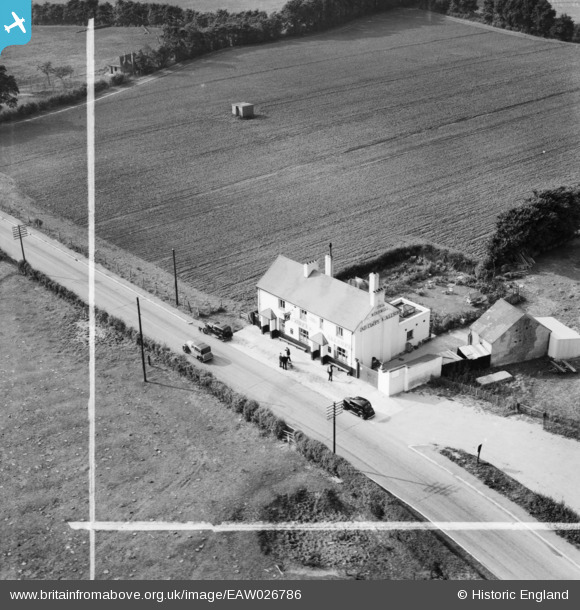
EAW026786 ENGLAND (1949). The Windmill Public House, Hoo St Werburgh, 1949. This image was marked by Aerofilms Ltd for photo editing.
© Copyright OpenStreetMap contributors and licensed by the OpenStreetMap Foundation. 2024. Cartography is licensed as CC BY-SA.
Nearby Images (6)
EAW026786

EAW026785

EAW026784

EAW026781

EAW026783

EAW026782

Details
| Title | [EAW026786] The Windmill Public House, Hoo St Werburgh, 1949. This image was marked by Aerofilms Ltd for photo editing. |
| Reference | EAW026786 |
| Date | 3-October-1949 |
| Link | |
| Place name | HOO ST WERBURGH |
| Parish | HOO ST. WERBURGH |
| District | |
| Country | ENGLAND |
| Easting / Northing | 577093, 172880 |
| Longitude / Latitude | 0.54765192766679, 51.426723417727 |
| National Grid Reference | TQ771729 |
Pins
 Sparky |
Tuesday 22nd of August 2017 10:25:33 PM | |
Sparky |
Tuesday 22nd of August 2017 10:25:06 PM | |
Sparky |
Tuesday 22nd of August 2017 10:24:28 PM | |
Sparky |
Tuesday 22nd of August 2017 10:24:28 PM | |
 Billy Turner |
Thursday 1st of December 2016 04:36:11 PM | |
Billy Turner |
Thursday 1st of December 2016 04:27:40 PM |