
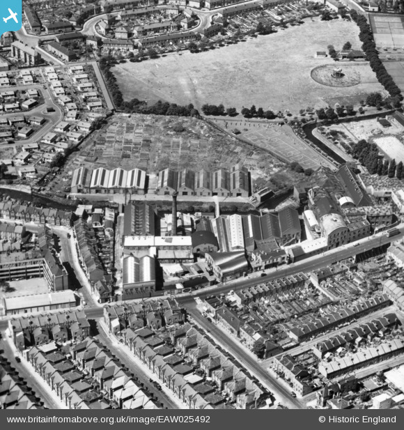
EAW025492 ENGLAND (1949). The Wandleside Cable Works, Wandsworth, 1949. This image has been produced from a print.
© Copyright OpenStreetMap contributors and licensed by the OpenStreetMap Foundation. 2024. Cartography is licensed as CC BY-SA.
Nearby Images (7)
EAW025492

EAW025493

EAW025491

EAW025489

EAW025490

EAW025494

EAW025488

Details
| Title | [EAW025492] The Wandleside Cable Works, Wandsworth, 1949. This image has been produced from a print. |
| Reference | EAW025492 |
| Date | 26-July-1949 |
| Link | |
| Place name | WANDSWORTH |
| Parish | |
| District | |
| Country | ENGLAND |
| Easting / Northing | 525757, 174027 |
| Longitude / Latitude | -0.18998114696286, 51.450754683095 |
| National Grid Reference | TQ258740 |
Pins
 Dom |
Tuesday 12th of May 2020 04:18:14 PM | |
Dom |
Tuesday 12th of May 2020 04:16:00 PM | |
brianbeckett |
Wednesday 1st of October 2014 08:05:00 PM | |
brianbeckett |
Wednesday 1st of October 2014 08:04:33 PM |


