
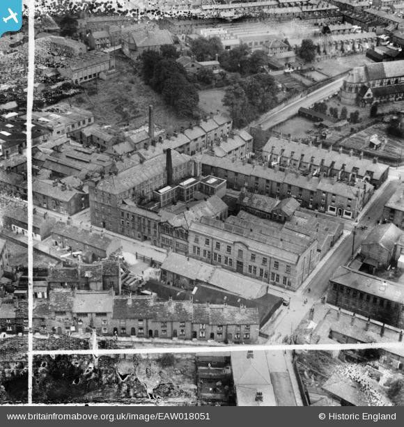
EAW018051 ENGLAND (1948). Silk Mill on Elizabeth Street, Macclesfield, 1948. This image was marked by Aerofilms Ltd for photo editing.
© Copyright OpenStreetMap contributors and licensed by the OpenStreetMap Foundation. 2024. Cartography is licensed as CC BY-SA.
Nearby Images (21)
EAW018051

EAW018053

EAW018049

EAW018055

EAW018054

EAW018052

EAW018056

EAW018050

EPW054376

EPW016738

EPW057643

EPW050711

EPW050714

EPW050715

EPW050716

EPW050713

EPW050712

EPW054374

EPW016745

EPW057374

EPW057641

Details
| Title | [EAW018051] Silk Mill on Elizabeth Street, Macclesfield, 1948. This image was marked by Aerofilms Ltd for photo editing. |
| Reference | EAW018051 |
| Date | 10-August-1948 |
| Link | |
| Place name | MACCLESFIELD |
| Parish | |
| District | |
| Country | ENGLAND |
| Easting / Northing | 391577, 373275 |
| Longitude / Latitude | -2.1262703256198, 53.256136763074 |
| National Grid Reference | SJ916733 |
Pins
Be the first to add a comment to this image!


