
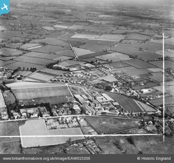
EAW015336 ENGLAND (1948). The Co-operative Brush and Woodware Factory and the surrounding area, Wymondham, from the south-west, 1948. This image has been produced from a print marked by Aerofilms Ltd for photo editing.
© Copyright OpenStreetMap contributors and licensed by the OpenStreetMap Foundation. 2024. Cartography is licensed as CC BY-SA.
Nearby Images (6)
EAW015336

EPW021567

EAW015332

EAW015333

EAW015334

EAW015335

Details
| Title | [EAW015336] The Co-operative Brush and Woodware Factory and the surrounding area, Wymondham, from the south-west, 1948. This image has been produced from a print marked by Aerofilms Ltd for photo editing. |
| Reference | EAW015336 |
| Date | 7-May-1948 |
| Link | |
| Place name | WYMONDHAM |
| Parish | WYMONDHAM |
| District | |
| Country | ENGLAND |
| Easting / Northing | 610545, 302205 |
| Longitude / Latitude | 1.107673745336, 52.57647480673 |
| National Grid Reference | TG105022 |
Pins
Be the first to add a comment to this image!


