
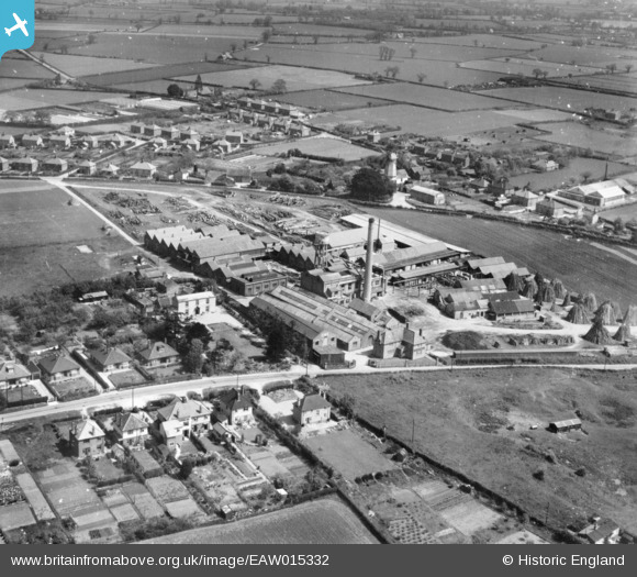
EAW015332 ENGLAND (1948). The Co-operative Brush and Woodware Factory, Wymondham, 1948. This image has been produced from a print.
© Copyright OpenStreetMap contributors and licensed by the OpenStreetMap Foundation. 2024. Cartography is licensed as CC BY-SA.
Nearby Images (6)
EAW015332

EPW021567

EAW015336

EAW015333

EAW015334

EAW015335

Details
| Title | [EAW015332] The Co-operative Brush and Woodware Factory, Wymondham, 1948. This image has been produced from a print. |
| Reference | EAW015332 |
| Date | 7-May-1948 |
| Link | |
| Place name | WYMONDHAM |
| Parish | WYMONDHAM |
| District | |
| Country | ENGLAND |
| Easting / Northing | 610597, 302246 |
| Longitude / Latitude | 1.1084661023958, 52.576822757966 |
| National Grid Reference | TG106022 |
Pins
 John W |
Sunday 26th of April 2020 09:55:59 PM |


