
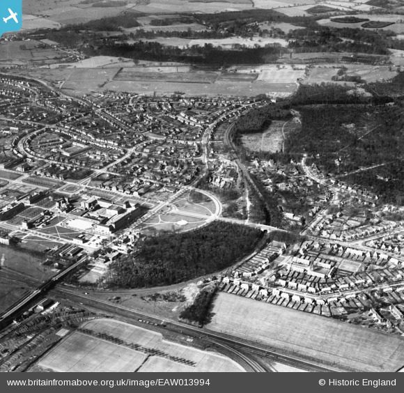
EAW013994 ENGLAND (1948). The Campus, Bridge Road and the surrounding town, Welwyn Garden City, 1948
© Copyright OpenStreetMap contributors and licensed by the OpenStreetMap Foundation. 2024. Cartography is licensed as CC BY-SA.
Nearby Images (19)
EAW013994

EPW062050

EPW025536

EPW047366

EPW022026

EPW062051

EPW022024

EPW062003

EPW022018

EPW062001

EPW062006

EPW062005

EPW022027

EAW013992

EPW022023

EPW025528

EPW062002

EPW047356

EPW013424

Details
| Title | [EAW013994] The Campus, Bridge Road and the surrounding town, Welwyn Garden City, 1948 |
| Reference | EAW013994 |
| Date | 23-March-1948 |
| Link | |
| Place name | WELWYN GARDEN CITY |
| Parish | |
| District | |
| Country | ENGLAND |
| Easting / Northing | 523547, 213302 |
| Longitude / Latitude | -0.20791398311761, 51.80424273503 |
| National Grid Reference | TL235133 |
Pins
 John Wass |
Tuesday 20th of January 2015 08:55:38 PM |


