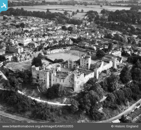
EAW010355 ENGLAND (1947). Ludlow Castle and environs, Ludlow, 1947. This image has been produced from a print.
© Copyright OpenStreetMap contributors and licensed by the OpenStreetMap Foundation. 2024. Cartography is licensed as CC BY-SA.
Nearby Images (8)
Details
| Title | [EAW010355] Ludlow Castle and environs, Ludlow, 1947. This image has been produced from a print. |
| Reference | EAW010355 |
| Date | 28-August-1947 |
| Link | |
| Place name | LUDLOW |
| Parish | LUDLOW |
| District | |
| Country | ENGLAND |
| Easting / Northing | 350851, 274611 |
| Longitude / Latitude | -2.7219217337344, 52.366959917859 |
| National Grid Reference | SO509746 |
Pins
Be the first to add a comment to this image!


![[EAW010355] Ludlow Castle and environs, Ludlow, 1947. This image has been produced from a print.](http://britainfromabove.org.uk/sites/all/libraries/aerofilms-images/public/100x100/EAW/010/EAW010355.jpg)
![[EAW010351] Ludlow Castle, Ludlow, 1947](http://britainfromabove.org.uk/sites/all/libraries/aerofilms-images/public/100x100/EAW/010/EAW010351.jpg)
![[EAW010354] Ludlow Castle, Ludlow, 1947. This image has been produced from a print.](http://britainfromabove.org.uk/sites/all/libraries/aerofilms-images/public/100x100/EAW/010/EAW010354.jpg)
![[EAW010349] Ludlow Castle and environs, Ludlow, 1947. This image has been produced from a print.](http://britainfromabove.org.uk/sites/all/libraries/aerofilms-images/public/100x100/EAW/010/EAW010349.jpg)
![[EAW010353] Ludlow Castle and environs, Ludlow, 1947](http://britainfromabove.org.uk/sites/all/libraries/aerofilms-images/public/100x100/EAW/010/EAW010353.jpg)
![[EAW010352] Ludlow Castle and the town, Ludlow, 1947](http://britainfromabove.org.uk/sites/all/libraries/aerofilms-images/public/100x100/EAW/010/EAW010352.jpg)
![[EAW010350] Ludlow Castle, Ludlow, 1947. This image has been produced from a print.](http://britainfromabove.org.uk/sites/all/libraries/aerofilms-images/public/100x100/EAW/010/EAW010350.jpg)
![[EPW016806] The town centre, Ludlow, 1926](http://britainfromabove.org.uk/sites/all/libraries/aerofilms-images/public/100x100/EPW/016/EPW016806.jpg)


