
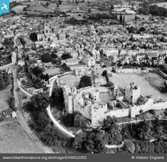
EAW010352 ENGLAND (1947). Ludlow Castle and the town, Ludlow, 1947
© Copyright OpenStreetMap contributors and licensed by the OpenStreetMap Foundation. 2024. Cartography is licensed as CC BY-SA.
Nearby Images (8)
EAW010352

EAW010353

EAW010349

EAW010355

EAW010351

EAW010354

EPW016806

EAW010350

Details
| Title | [EAW010352] Ludlow Castle and the town, Ludlow, 1947 |
| Reference | EAW010352 |
| Date | 28-August-1947 |
| Link | |
| Place name | LUDLOW |
| Parish | LUDLOW |
| District | |
| Country | ENGLAND |
| Easting / Northing | 350918, 274635 |
| Longitude / Latitude | -2.7209412061224, 52.367181695865 |
| National Grid Reference | SO509746 |
Pins
 Gary White |
Sunday 26th of January 2014 08:40:06 PM |


