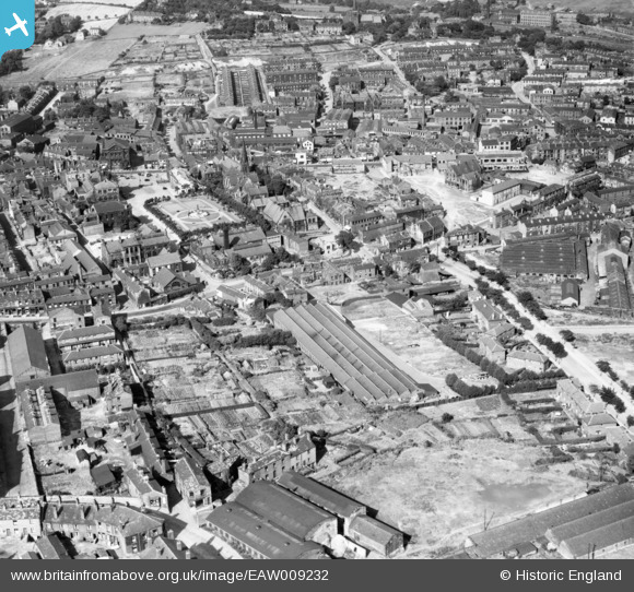
EAW009232 ENGLAND (1947). Fox's Biscuit Factory and environs, Batley, 1947
© Copyright OpenStreetMap contributors and licensed by the OpenStreetMap Foundation. 2024. Cartography is licensed as CC BY-SA.
Nearby Images (18)
EAW009232

EAW013704

EAW013698

EAW013701

EAW013702

EAW013700

EAW009233

EAW009234

EAW013702A

EAW013703

EAW009231

EAW013699

EAW009229

EAW009230

EAW009235

EAW013705

EAW013706

EAW009236

Details
| Title | [EAW009232] Fox's Biscuit Factory and environs, Batley, 1947 |
| Reference | EAW009232 |
| Date | 16-August-1947 |
| Link | |
| Place name | BATLEY |
| Parish | |
| District | |
| Country | ENGLAND |
| Easting / Northing | 424260, 424025 |
| Longitude / Latitude | -1.6323957094773, 53.711856109219 |
| National Grid Reference | SE243240 |
Pins
 kieron hill |
Monday 20th of June 2016 08:32:23 PM | |
kieron hill |
Friday 17th of June 2016 08:43:43 PM | |
Stan |
Sunday 30th of November 2014 07:19:54 PM | |
 Cabby |
Monday 10th of March 2014 06:30:08 PM | |
Cabby |
Sunday 9th of March 2014 10:51:28 PM |