
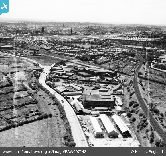
EAW007242 ENGLAND (1947). The Parker Foundry on Mansfield Road and the city, Derby, from the north-east, 1947. This image was marked by Aerofilms Ltd for photo editing.
© Copyright OpenStreetMap contributors and licensed by the OpenStreetMap Foundation. 2024. Cartography is licensed as CC BY-SA.
Nearby Images (7)
EAW007242

EAW007244

EAW007246

EAW007245

EAW007240

EAW007241

EAW007239

Details
| Title | [EAW007242] The Parker Foundry on Mansfield Road and the city, Derby, from the north-east, 1947. This image was marked by Aerofilms Ltd for photo editing. |
| Reference | EAW007242 |
| Date | 25-June-1947 |
| Link | |
| Place name | DERBY |
| Parish | |
| District | |
| Country | ENGLAND |
| Easting / Northing | 436069, 337869 |
| Longitude / Latitude | -1.4632729829439, 52.936689188796 |
| National Grid Reference | SK361379 |
Pins
 aremla |
Monday 20th of November 2023 04:25:40 PM | |
aremla |
Monday 20th of November 2023 04:23:28 PM | |
aremla |
Monday 20th of November 2023 04:22:08 PM | |
aremla |
Monday 20th of November 2023 04:20:11 PM | |
aremla |
Monday 20th of November 2023 04:19:06 PM | |
aremla |
Monday 20th of November 2023 04:18:24 PM | |
aremla |
Monday 20th of November 2023 04:17:27 PM | |
HelsyB |
Thursday 5th of October 2023 05:10:00 PM |


