
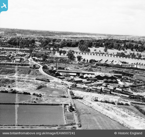
EAW007241 ENGLAND (1947). The Parker Foundry on Mansfield Road and environs, Derby, from the east, 1947. This image was marked by Aerofilms Ltd for photo editing.
© Copyright OpenStreetMap contributors and licensed by the OpenStreetMap Foundation. 2024. Cartography is licensed as CC BY-SA.
Nearby Images (9)
EAW007241

EAW007239

EAW007244

EAW007247

EAW007246

EAW007245

EAW007240

EAW007243

EAW007242

Details
| Title | [EAW007241] The Parker Foundry on Mansfield Road and environs, Derby, from the east, 1947. This image was marked by Aerofilms Ltd for photo editing. |
| Reference | EAW007241 |
| Date | 25-June-1947 |
| Link | |
| Place name | DERBY |
| Parish | |
| District | |
| Country | ENGLAND |
| Easting / Northing | 436000, 337656 |
| Longitude / Latitude | -1.4643233384294, 52.934778968028 |
| National Grid Reference | SK360377 |
Pins
 aremla |
Monday 20th of November 2023 04:12:28 PM | |
aremla |
Monday 20th of November 2023 04:07:44 PM | |
HelsyB |
Thursday 5th of October 2023 05:08:15 PM | |
HelsyB |
Thursday 5th of October 2023 05:06:56 PM | |
HelsyB |
Thursday 5th of October 2023 05:05:24 PM |


