
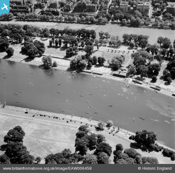
EAW006458 ENGLAND (1947). The Serpentine, Hyde Park, 1947
© Copyright OpenStreetMap contributors and licensed by the OpenStreetMap Foundation. 2024. Cartography is licensed as CC BY-SA.
Nearby Images (9)
EAW006458

EAW006459

EAW006456

EAW021736

EAW006457

EPW052917
, Westminster, 1937")
EPW061239

EPW052914
, Westminster, 1937. This image has been produced from a copy-negative.")
EPW020958

Details
| Title | [EAW006458] The Serpentine, Hyde Park, 1947 |
| Reference | EAW006458 |
| Date | 2-June-1947 |
| Link | |
| Place name | HYDE PARK |
| Parish | |
| District | |
| Country | ENGLAND |
| Easting / Northing | 527150, 180042 |
| Longitude / Latitude | -0.16777715202132, 51.504506023892 |
| National Grid Reference | TQ272800 |
Pins
 Alan McFaden |
Thursday 7th of November 2013 04:09:24 PM | |
Alan McFaden |
Thursday 7th of November 2013 04:08:38 PM |


