
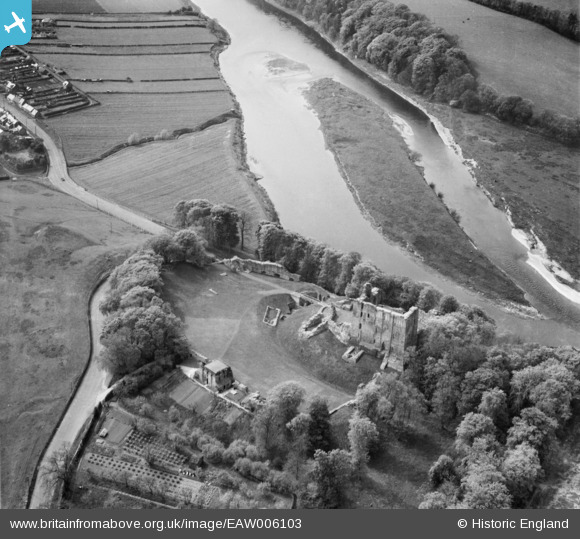
EAW006103 ENGLAND (1947). Norham Castle and Blount Island, Norham, 1947
© Copyright OpenStreetMap contributors and licensed by the OpenStreetMap Foundation. 2024. Cartography is licensed as CC BY-SA.
Nearby Images (10)
EAW006103

EAW016849

EAW016850

EAW016848

EAW016847

EAW006105

EAW006106

EAW006107

EAW006104

EAW006108

Details
| Title | [EAW006103] Norham Castle and Blount Island, Norham, 1947 |
| Reference | EAW006103 |
| Date | 21-May-1947 |
| Link | |
| Place name | NORHAM |
| Parish | NORHAM |
| District | |
| Country | ENGLAND |
| Easting / Northing | 390516, 647632 |
| Longitude / Latitude | -2.1509984031292, 55.722026834345 |
| National Grid Reference | NT905476 |
Pins
Be the first to add a comment to this image!


