
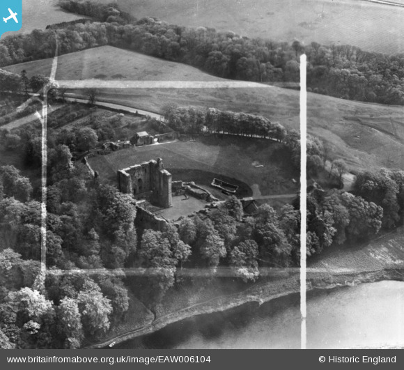
EAW006104 ENGLAND (1947). Norham Castle, Norham, 1947. This image has been produced from a print marked by Aerofilms Ltd for photo editing.
© Copyright OpenStreetMap contributors and licensed by the OpenStreetMap Foundation. 2024. Cartography is licensed as CC BY-SA.
Nearby Images (10)
EAW006104

EAW006107

EAW006106

EAW006105

EAW016847

EAW016848

EAW016850

EAW006103

EAW016849

EAW006108

Details
| Title | [EAW006104] Norham Castle, Norham, 1947. This image has been produced from a print marked by Aerofilms Ltd for photo editing. |
| Reference | EAW006104 |
| Date | 21-May-1947 |
| Link | |
| Place name | NORHAM |
| Parish | NORHAM |
| District | |
| Country | ENGLAND |
| Easting / Northing | 390617, 647568 |
| Longitude / Latitude | -2.1493881542222, 55.721453688326 |
| National Grid Reference | NT906476 |
Pins
Be the first to add a comment to this image!


