
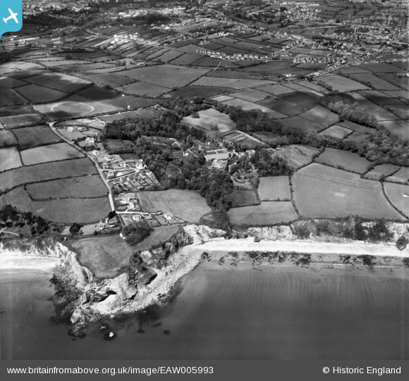
EAW005993 ENGLAND (1947). Duporth Holiday Camp, Duporth, 1947
© Copyright OpenStreetMap contributors and licensed by the OpenStreetMap Foundation. 2024. Cartography is licensed as CC BY-SA.
Nearby Images (23)
EAW005993

EAW005987

EAW011851

EAW005990

EAW011857

EAW011855

EAW005991

EAW011854

EAW011859

EAW005985

EAW011850

EAW011850
EAW005986

EAW005988

EAW005994

EAW005989

EAW011852

EAW011853

EAW011856

EAW005995

EAW011858

EAW011847

EAW005992

Details
| Title | [EAW005993] Duporth Holiday Camp, Duporth, 1947 |
| Reference | EAW005993 |
| Date | 18-May-1947 |
| Link | |
| Place name | DUPORTH |
| Parish | ST. AUSTELL BAY |
| District | |
| Country | ENGLAND |
| Easting / Northing | 203280, 51164 |
| Longitude / Latitude | -4.7641619955192, 50.326906461763 |
| National Grid Reference | SX033512 |
Pins
 CornwallPhil |
Monday 16th of June 2014 11:08:45 PM | |
longshot |
Monday 4th of November 2013 06:55:15 PM |


