
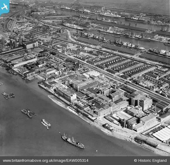
EAW005314 ENGLAND (1947). The Standard Industrial Estate alongside the Royal Albert Dock, North Woolwich, 1947
© Copyright OpenStreetMap contributors and licensed by the OpenStreetMap Foundation. 2024. Cartography is licensed as CC BY-SA.
Nearby Images (32)
EAW005314

EPW057954

EAW005319

EAW008314

EAW008316

EAW005315

EAW005316

EAW005311

EAW005312

EPW057953

EPW050842

EPW057950

EPW057947

EPW050840

EPW036586

EPW008295

EAW008315

EPW036583

EAW005317

EAW005310

EPW050843

EPW036584

EAW005313

EPW057949

EPW050841

EPW050844

EPW057948

EPW036585

EAW005318

EPW006145

EAW572435

EPW024252

Details
| Title | [EAW005314] The Standard Industrial Estate alongside the Royal Albert Dock, North Woolwich, 1947 |
| Reference | EAW005314 |
| Date | April-1947 |
| Link | |
| Place name | NORTH WOOLWICH |
| Parish | |
| District | |
| Country | ENGLAND |
| Easting / Northing | 542767, 179918 |
| Longitude / Latitude | 0.057065082718288, 51.499661928105 |
| National Grid Reference | TQ428799 |
Pins
Be the first to add a comment to this image!


