
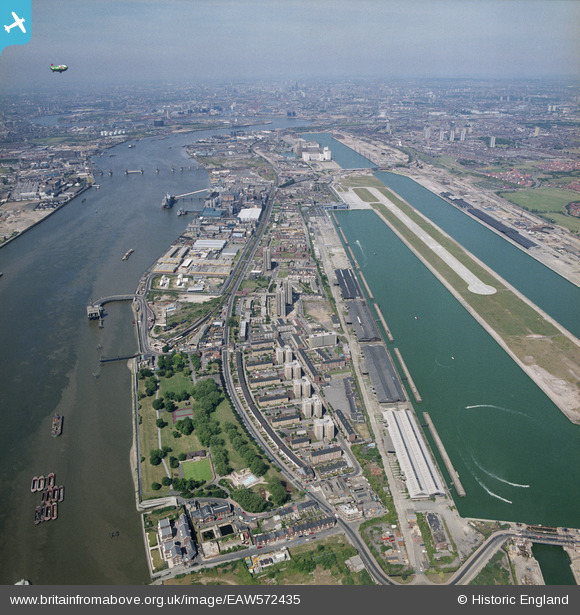
EAW572435 ENGLAND (1989). King George V Dock, London, 1989
© Copyright OpenStreetMap contributors and licensed by the OpenStreetMap Foundation. 2024. Cartography is licensed as CC BY-SA.
Nearby Images (22)
EAW572435

EAW005318

EPW057949

EPW057947

EAW005313

EAW005319

EPW057950

EPW036586

EPW036584

EPW057954

EAW005314

EPW008295

EPW050840

EAW008316

EPW050842

EAW008315

EAW005312

EAW005315

EAW005311

EAW005316

EAW008314

EPW057953

Details
| Title | [EAW572435] King George V Dock, London, 1989 |
| Reference | EAW572435 |
| Date | 16-June-1989 |
| Link | |
| Place name | LONDON |
| Parish | NON CIVIL PARISH |
| District | |
| Country | ENGLAND |
| Easting / Northing | 542990, 180069 |
| Longitude / Latitude | 0.060337169311675, 51.500962541313 |
| National Grid Reference | TQ430801 |
Pins
 Tipton |
Thursday 24th of August 2023 06:25:15 PM | |
 |
MikeBellew |
Thursday 13th of October 2016 03:44:42 PM |
MikeBellew |
Thursday 13th of October 2016 03:44:21 PM | |
MikeBellew |
Thursday 13th of October 2016 03:37:54 PM | |
 Billy Turner |
Monday 26th of September 2016 10:41:12 PM |


