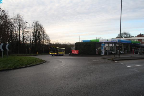
EPW016853 ENGLAND (1926). Farningham Service Station and environs, Farningham, 1926

© Hawlfraint cyfranwyr OpenStreetMap a thrwyddedwyd gan yr OpenStreetMap Foundation. 2024. Trwyddedir y gartograffeg fel CC BY-SA.
Delweddau cyfagos (15)
EPW016853

EPW016851

EPW016847

EPW016985

EPW016849

EPW016986
 and petrol station, Farningham, 1926")
EPW016845

EPW016852

EPW016850

EPW016846

EPW016987
 and petrol station, Farningham, 1926")
EPW016844

EPW016983
 and petrol station, Farningham, 1926")
EPW016848

EPW016984
 and petrol station, Farningham, 1926")
Manylion
| Pennawd | [EPW016853] Farningham Service Station and environs, Farningham, 1926 |
| Cyfeirnod | EPW016853 |
| Dyddiad | August-1926 |
| Dolen | |
| Enw lle | FARNINGHAM |
| Plwyf | FARNINGHAM |
| Ardal | |
| Gwlad | ENGLAND |
| Dwyreiniad / Gogleddiad | 554664, 167210 |
| Hydred / Lledred | 0.22279692359358, 51.382339918592 |
| Cyfeirnod Grid Cenedlaethol | TQ547672 |
Pinnau
 Gone2Kent |
Sunday 5th of January 2014 11:55:14 AM | |
Gone2Kent |
Tuesday 31st of December 2013 07:45:56 PM | |
Gone2Kent |
Tuesday 31st of December 2013 07:36:42 PM | |
Gone2Kent |
Tuesday 31st of December 2013 07:34:12 PM | |
Gone2Kent |
Tuesday 31st of December 2013 07:29:37 PM | |
Gone2Kent |
Tuesday 31st of December 2013 07:21:21 PM | |
Gone2Kent |
Tuesday 31st of December 2013 07:16:08 PM |