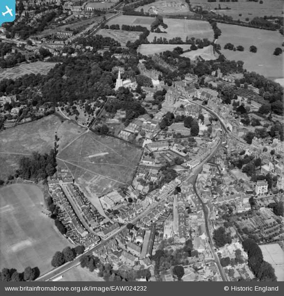
EAW024232 ENGLAND (1949). Harrow School, Harrow on the Hill, 1949
© Hawlfraint cyfranwyr OpenStreetMap a thrwyddedwyd gan yr OpenStreetMap Foundation. 2024. Trwyddedir y gartograffeg fel CC BY-SA.
Delweddau cyfagos (25)
EAW024232

EPW025547

EPW000467

EPW000469

EPW000468

EPW000462

EPW000463

EPW053679

EAW042771

EPW006290

EPW005357

EAW014888

EAW042768

EPW005356

EAW042770

EAW042772

EAW042769

EPW006295

EAW014885

EPW053680

EAW042767

EPW018764

EPW000461

EPW000470

EPW000466

Manylion
| Pennawd | [EAW024232] Harrow School, Harrow on the Hill, 1949 |
| Cyfeirnod | EAW024232 |
| Dyddiad | 27-June-1949 |
| Dolen | |
| Enw lle | HARROW ON THE HILL |
| Plwyf | |
| Ardal | |
| Gwlad | ENGLAND |
| Dwyreiniad / Gogleddiad | 515193, 187349 |
| Hydred / Lledred | -0.33760297636288, 51.572750459898 |
| Cyfeirnod Grid Cenedlaethol | TQ152873 |
Pinnau
 The Laird |
Thursday 20th of February 2020 05:28:07 PM | |
The Laird |
Thursday 20th of February 2020 05:26:20 PM | |
The Laird |
Thursday 20th of February 2020 05:25:20 PM | |
czyrko |
Sunday 27th of April 2014 07:46:09 AM | |
czyrko |
Sunday 27th of April 2014 07:45:16 AM | |
 Class31 |
Sunday 6th of April 2014 05:01:59 PM |