
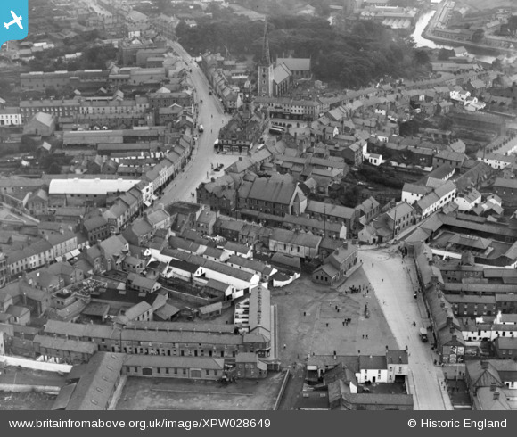
xpw028649 NORTHERN IRELAND (1929). General View, Lambeg, Lisburn, Northern Ireland, 1929. Oblique aerial photograph taken facing North/East.
© Copyright OpenStreetMap contributors and licensed by the OpenStreetMap Foundation. 2026. Cartography is licensed as CC BY-SA.
Nearby Images (5)
XPW028649

XPW028656

XPW028655

XPW008433A

XPW008437

Details
| Title | [XPW028649] General View, Lambeg, Lisburn, Northern Ireland, 1929. Oblique aerial photograph taken facing North/East. |
| Reference | XPW028649 |
| Date | 1929 |
| Link | |
| Place name | LAMBEG |
| Parish | NORTHERN IRELAND |
| District | |
| Country | NORTHERN IRELAND |
| Easting / Northing | 138360, 520340 |
| Longitude / Latitude | -6.043567, 54.510646 |
| National Grid Reference |
Pins

Davidg1965 |
Friday 2nd of April 2021 10:07:59 PM | |
|
Davidg1965 |
Friday 2nd of April 2021 09:37:12 PM | |
|
Neil |
Saturday 20th of February 2016 06:43:07 PM | |
|
OJGW |
Friday 2nd of January 2015 12:16:53 PM | |
|
OJGW |
Friday 2nd of January 2015 12:16:18 PM | |
|
OJGW |
Friday 2nd of January 2015 12:14:36 PM | |
|
Buzby |
Sunday 14th of December 2014 10:16:06 AM | |
|
Buzby |
Sunday 14th of December 2014 10:15:23 AM | |
I think called Smithfield Square |
OJGW |
Friday 2nd of January 2015 12:15:37 PM |