
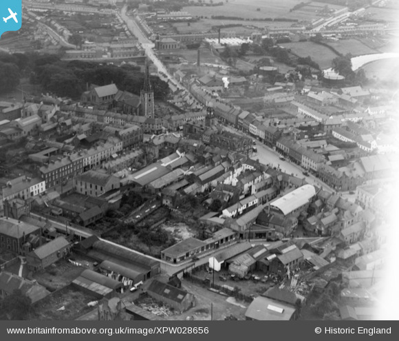
XPW028656 NORTHERN IRELAND (1929). General View, Lambeg, Lisburn, Northern Ireland, 1929. Oblique aerial photograph taken facing South/East.
© Copyright OpenStreetMap contributors and licensed by the OpenStreetMap Foundation. 2026. Cartography is licensed as CC BY-SA.
Nearby Images (5)
XPW028656

XPW008433A

XPW028649

XPW028655

XPW008437

Details
| Title | [XPW028656] General View, Lambeg, Lisburn, Northern Ireland, 1929. Oblique aerial photograph taken facing South/East. |
| Reference | XPW028656 |
| Date | 1929 |
| Link | |
| Place name | LAMBEG |
| Parish | NORTHERN IRELAND |
| District | |
| Country | NORTHERN IRELAND |
| Easting / Northing | 138337, 520422 |
| Longitude / Latitude | -6.043995, 54.511364 |
| National Grid Reference |
Pins
Be the first to add a comment to this image!