
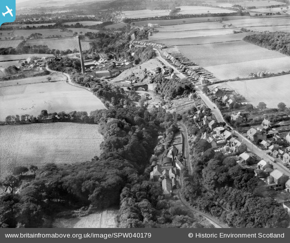
spw040179 SCOTLAND (1932). Currie, general view, showing Lanark Road and Kinleith Paper Mills. An oblique aerial photograph taken facing west.
© Copyright OpenStreetMap contributors and licensed by the OpenStreetMap Foundation. 2025. Cartography is licensed as CC BY-SA.
Nearby Images (3)
SPW040176

SPW040179

SPW040180

Details
| Title | [SPW040179] Currie, general view, showing Lanark Road and Kinleith Paper Mills. An oblique aerial photograph taken facing west. |
| Reference | SPW040179 |
| Date | 1932 |
| Link | Canmore Collection item 1257267 |
| Place name | |
| Parish | CURRIE |
| District | CITY OF EDINBURGH |
| Country | SCOTLAND |
| Easting / Northing | 319283, 668222 |
| Longitude / Latitude | -3.2910560169586, 55.90037450535 |
| National Grid Reference | NT193682 |
Pins
 Alastair Charles |
Monday 20th of July 2015 07:27:13 PM | |
Alastair Charles |
Monday 20th of July 2015 07:25:05 PM | |
Alastair Charles |
Monday 20th of July 2015 07:24:18 PM |