
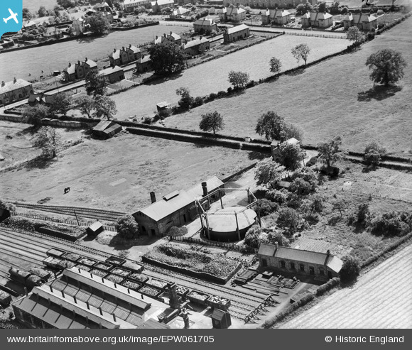
epw061705 ENGLAND (1939). The Gas Works, Craven Arms, 1939
© Copyright OpenStreetMap contributors and licensed by the OpenStreetMap Foundation. 2024. Cartography is licensed as CC BY-SA.
Nearby Images (5)
EPW061705

EPW061706

EPW061708

EPW061704

EPW061707

Details
| Title | [EPW061705] The Gas Works, Craven Arms, 1939 |
| Reference | EPW061705 |
| Date | 10-June-1939 |
| Link | |
| Place name | CRAVEN ARMS |
| Parish | CRAVEN ARMS |
| District | |
| Country | ENGLAND |
| Easting / Northing | 343055, 283077 |
| Longitude / Latitude | -2.8378611527342, 52.442315759702 |
| National Grid Reference | SO431831 |
Pins
 Andrew Bennett |
Tuesday 29th of October 2013 11:12:45 PM | |
Andrew Bennett |
Tuesday 29th of October 2013 11:09:56 PM | |
Andrew Bennett |
Tuesday 29th of October 2013 11:09:18 PM | |
Andrew Bennett |
Tuesday 29th of October 2013 11:07:11 PM |


