
Downtime message
Due to planned maintenance taking place on Thursday 9th October between 9:00 AM and 1:00 PM, services might be disrupted or temporarily unavailable. We apologise for any inconvenience.
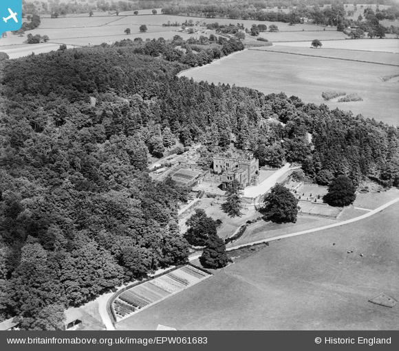
epw061683 ENGLAND (1939). Ruyton Manor, Ruyton-XI-Towns, 1939
© Copyright OpenStreetMap contributors and licensed by the OpenStreetMap Foundation. 2025. Cartography is licensed as CC BY-SA.
Nearby Images (4)
EPW061683

EPW061681

EPW061680

EPW061678

Details
| Title | [EPW061683] Ruyton Manor, Ruyton-XI-Towns, 1939 |
| Reference | EPW061683 |
| Date | 8-June-1939 |
| Link | |
| Place name | RYTON-XI-TOWNS |
| Parish | RUYTON-XI-TOWNS |
| District | |
| Country | ENGLAND |
| Easting / Northing | 337888, 322840 |
| Longitude / Latitude | -2.921351234155, 52.799207847345 |
| National Grid Reference | SJ379228 |
Pins

totoro |
Monday 23rd of September 2013 07:21:25 PM | |
|
totoro |
Monday 23rd of September 2013 07:19:50 PM | |
|
totoro |
Monday 23rd of September 2013 07:18:24 PM | |
|
totoro |
Monday 23rd of September 2013 07:14:46 PM | |
|
totoro |
Monday 23rd of September 2013 07:13:05 PM |

User Comment Contributions
This view is looking towards the North East |
totoro |
Monday 23rd of September 2013 07:23:29 PM |