
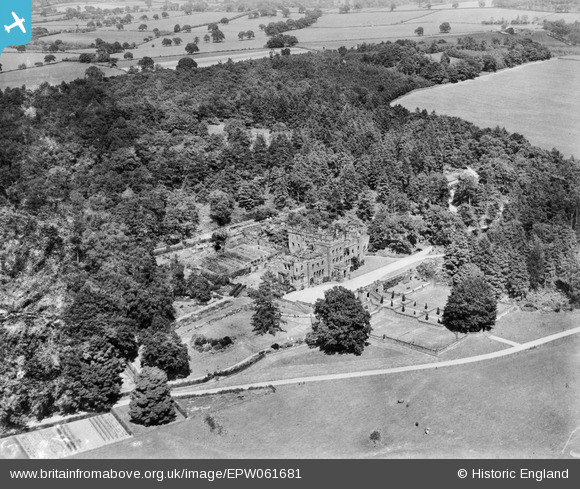
EPW061681 ENGLAND (1939). Ruyton Manor, Ruyton-XI-Towns, 1939
© Copyright OpenStreetMap contributors and licensed by the OpenStreetMap Foundation. 2026. Cartography is licensed as CC BY-SA.
Nearby Images (4)
EPW061681

EPW061683

EPW061680

EPW061678

Details
| Title | [EPW061681] Ruyton Manor, Ruyton-XI-Towns, 1939 |
| Reference | EPW061681 |
| Date | 8-June-1939 |
| Link | |
| Place name | RYTON-XI-TOWNS |
| Parish | RUYTON-XI-TOWNS |
| District | |
| Country | ENGLAND |
| Easting / Northing | 337884, 322830 |
| Longitude / Latitude | -2.9214086606231, 52.799117493142 |
| National Grid Reference | SJ379228 |
Pins

totoro |
Tuesday 24th of September 2013 08:43:29 AM | |
|
totoro |
Tuesday 24th of September 2013 08:42:49 AM | |
|
totoro |
Tuesday 24th of September 2013 08:41:57 AM |