
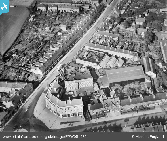
epw051932 ENGLAND (1936). Hardings Royal Steam Bakery, Yardley, 1936
© Copyright OpenStreetMap contributors and licensed by the OpenStreetMap Foundation. 2025. Cartography is licensed as CC BY-SA.
Nearby Images (10)
EPW051932

EPW051938

EPW051935

EPW051939

EPW051930

EPW051934

EPW051933

EPW051936

EPW051931

EPW051937

Details
| Title | [EPW051932] Hardings Royal Steam Bakery, Yardley, 1936 |
| Reference | EPW051932 |
| Date | October-1936 |
| Link | |
| Place name | YARDLEY |
| Parish | |
| District | |
| Country | ENGLAND |
| Easting / Northing | 412692, 284959 |
| Longitude / Latitude | -1.8131741587992, 52.462057155756 |
| National Grid Reference | SP127850 |
Pins
 totoro |
Wednesday 21st of May 2014 08:33:35 PM | |
totoro |
Wednesday 21st of May 2014 08:24:59 PM | |
totoro |
Wednesday 21st of May 2014 08:23:09 PM | |
totoro |
Wednesday 21st of May 2014 08:21:57 PM |
User Comment Contributions
This area has been seriously redeveloped, I doubt if there is a building in this image still standing- apart from the terraced houses on Lily Road. I cannot locate where "royal steam" came from but Hardings Bakery was well known, purchased some other companies, and went into Allied Bakeries. Mothers Pride and Mr Kipling are associated trade names associated with this bakery. When the first shopping centre was built the bakery moved to Granby Avenue and became Milanda's. |
totoro |
Saturday 22nd of October 2016 04:03:54 PM |
I don't think Lily Road appears in this photo? Lily Road is a bit further along the Coventry Road, left off the main road (travelling out of the City) just past what was the Tivoli Cinema. |
Roy |
Saturday 22nd of October 2016 04:03:54 PM |