
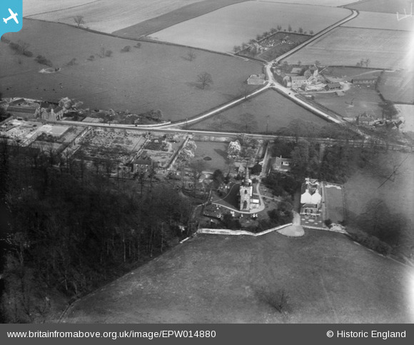
epw014880 ENGLAND (1926). St Leonard's Church, Thrybergh, 1926
© Copyright OpenStreetMap contributors and licensed by the OpenStreetMap Foundation. 2025. Cartography is licensed as CC BY-SA.
Nearby Images (2)
EPW014880

EPW015432

Details
| Title | [EPW014880] St Leonard's Church, Thrybergh, 1926 |
| Reference | EPW014880 |
| Date | 22-May-1926 |
| Link | |
| Place name | THRYBERGH |
| Parish | THRYBERGH |
| District | |
| Country | ENGLAND |
| Easting / Northing | 446746, 395513 |
| Longitude / Latitude | -1.295965741327, 53.454041889033 |
| National Grid Reference | SK467955 |
