
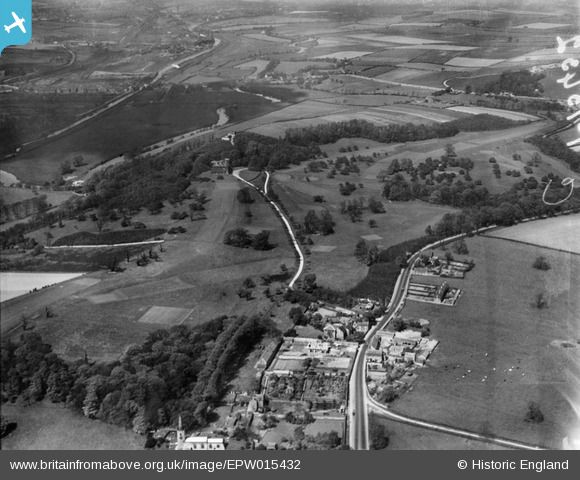
EPW015432 ENGLAND (1926). Thrybergh Park and the Rotherham Golf Club, Thrybergh, from the south, 1926
© Copyright OpenStreetMap contributors and licensed by the OpenStreetMap Foundation. 2025. Cartography is licensed as CC BY-SA.
Nearby Images (3)
EPW015432

EPW014880

EPW015431

Details
| Title | [EPW015432] Thrybergh Park and the Rotherham Golf Club, Thrybergh, from the south, 1926 |
| Reference | EPW015432 |
| Date | 3-May-1926 |
| Link | |
| Place name | THRYBERGH |
| Parish | THRYBERGH |
| District | |
| Country | ENGLAND |
| Easting / Northing | 446732, 395608 |
| Longitude / Latitude | -1.2961624557875, 53.454897072092 |
| National Grid Reference | SK467956 |
Pins
Be the first to add a comment to this image!